Description
Throughout your hike, you will discover the hidden mysteries of the countryside, the forest, the hills and the banks of the Seine.
You will stroll along the paths of the history of France and Normandy, such as the discreet marriage of Blanche of Castile with Louis VIII, the miraculous Saint Adjutor (patron of sailors), as well as the secret of the Gargantua gravel and many other other adventures around the villages. YELLOW color marking.
All the hiking trails in our region are on sale in the tourist information offices of Vernon, Giverny, Les Andelys and Pacy-sur-Eure.
Duration of the mountain bike ride: 2 hours.
1 - From the trail sign, take a left towards the Seine for 150 m. Take the first path on the left and continue to the road. Turn right until you reach the calvaire (cross).
2 - At the cross, take the forest track heading up the Courbe Valley, past the Poteau des Quatre-Triages and the Malira Farm.
3 - Turn left onto the path leading to the hamlet of Corville. Cross a road, continue for 50m then bear left onto a path straight across the fields before entering Vernon forest.
4 - Turn right onto the François 1er forest trail for 1 km. Be careful, this downhill path is very steep.
5 - At the bottom, turn left onto the path, then follow the D8 road to the left towards Pressagny-le-Val for 500 m. At the first junction, turn right onto Rue Camille Isambard, cross the Catenay brook (former mill site) and take the D10 to the left.
6 - At the crossroads, turn right onto Rue Lucien Lefrançois, towards Port Mort. As you leave the village, take the first path on the right. At the junction, take the path leading uphill and which joins the Hennezis road.
7 - Climb up to your right at the Thuit farm and take the path to the left. Follow the path and continue through the woods to the junction of the private and public woods. Turn left onto the path that takes you down to the Port Mort field.
8 - Turn right for 250 m. Continue to the right towards the Port-Mort castles. Continue straight ahead, past the wide Chemin des Vignes path. When you reach the D313, cross the road, walk along the castle wall to the crossroads and turn left towards the Seine.
9 - Follow the path to your left along the Seine then the towpath for 800 m. At the second intersection, turn left onto Rue de Seine which takes you towards the farm. Turn right onto Rue de Falaise and bear right onto the path to the next road, up to the cemetery and past the farm, and follow the path leading to the equestrian centre and towards Notre-Dame-de-l’Isle.
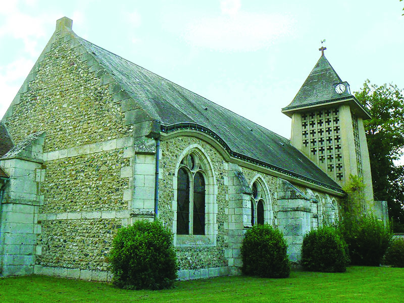
10 - As you enter the village, take the second footpath on your right and walk to the Seine river bank. Follow the river in the direction of Pressagny-l’Orgueilleux church. Follow the castle wall and turn left to return to the town hall.
Practical Information
Distance
21.7 Km
Duration
06:00:00 h
Difficulty
Average
