Description
Between the slopes of the Seine, landscapes of the valley and remarkable local heritage. YELLOW markup.
All the hiking trails in our area are on sale at the tourist information offices in Vernon, Giverny, Les Andelys and Pacy-sur-Eure.
Duration of the mountain bike ride: 1h15.
1 - From the car park, go past the church porch and take the lane across the way. Turn left towards the housing estate and pass through it to take the footpath through the fields leading to the cemetery. Go around it on the left, towards the village. Carefully cross the road on the left.
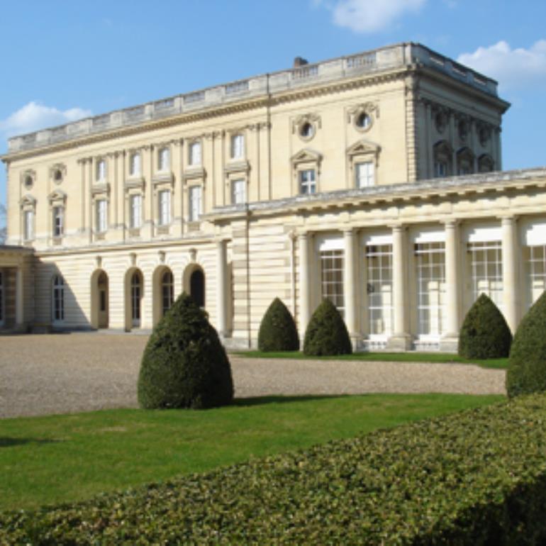
2 - About 100 m further on, turn right onto Rue de la Petite Garenne which leads to the tree-lined Avenue du Château. Turn left and walk towards the castle, crossing one road along the way.
3 - After another 100 m, turn right onto a footpath between fences (follow the waymarks). Turn left onto Rue de la Haute Marâtre for 100 m. Turn right onto Rue de la Grande Sente. Bear left onto Rue Rognon, straight on to Rue du Fournel then bear left onto Rue A-G Poulain.
4 - After 300 m, turn left onto the Sente des Moulins which climbs up to meet Rue du Fournel.
5 - Follow the road for 70 m then turn right onto the hillside path. At the junc-
tion, go down to the right then take the first left onto the path between the meadows.
6 - Continue for 500 m then take the path heading up to the left. Turn left
again at the next path junction. Climb up to the junction with the road.
Cross the road and take the path starting near the town name signpost.
7 - Continue through the woods until you reach a clearing then turn left onto
a path leading to the meadow. Go down the track on your left.
8 - At the junction, take the path to the right, then left along the castle wall.
Join the road for 80 m, past the lavoir (public washing place), then take
the path up to the right. In front of the castle gate, take Rue du Potager
along the castle’s vegetable garden. Continue straight ahead.
9 - Take the 2nd street to the right, Rue de la Corne Haute. On the plateau,
follow the footpath which turns 90° to the left, then turn left after 100
m. Go down the hillside, cross the road and follow the footpath until you
reach Rue Saint-Martin.
10 - Continue straight across the street, taking the Sentier Jurée path. Bear to
the left, following the footpath along the houses. At the end, turn right
for 50 m and then to the left until you reach the street. Take Rue du Clos
Biron opposite then turn right onto Rue Trutin to return to the car park.
Practical Information
Distance
10.4 Km
Duration
03:30:00 h

